Angela Akenson
Typhoon Haishen today made landfall in southern Japan, prompting authorities to issue warnings calling for millions of people to seek shelter.
Typhoon Haishen is expected to cause record rain and gusts of wind strong enough to overturn the car.
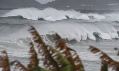
The waves hit the coast when Typhoon Haishen reached Makurazaki city, Kagoshima Prefecture, Japan, on September 6 Photo: AFP.
After hitting a series of remote southern islands, the storm tonight approached the Kyushu area.
The weather agency requires people to "be on maximum alert" against the possibility of heavy rain, strong winds, high waves and high tide.
"The rainfall forecast will be very large. It could cause landslides or even flood large rivers," Yoshihisa Nakamoto, director of the forecasting division of the Japan Meteorological Agency, said during a meeting.
At about 7:00 p.m. on September 6, Typhoon Haishen was only about 100 kilometers southwest of Makurazaki city, Kagoshima Prefecture, with a wind force of 216 km / h, strong enough to overturn a car and break a wooden electric pole.
An evacuation order in Japan is not mandatory, but the government recommends that everyone obey.
The storm caused nearly 550 flights to be canceled, disrupting railway services, NHK reported.